Algorithm
Various techniques can be used to track non-rigid objects like rain cells [1] [2] [3] [4] [5] [6] [7] [8] [9]. This algorithm applies geometry overlapping methods to track and forecast individual rain cells from satellites or radar data, considering their interactions during development and movement. Key parameters like minimum size and identification thresholds must be defined for tracking rain systems. These parameters impact the average size, internal structure, and lifetime of the systems. Several steps are involved to ensure effective tracking.
The algorithm workflow consists of four stages: identification, tracking, corrections, and forecast. In the identification stage, rain clusters (rain cells) are detected and converted into vector objects (polygons). The tracking stage involves comparing geometries at consecutive times to determine cell displacement. Corrections may be necessary to address unrealistic displacement vectors caused by shape changes, cell fusion, splitting, or radar errors. The forecast stage validates the correction method by predicting rain cell movement using the corrected vectors and comparing it to observed data. This conservative validation assumes minimal changes in subsequent observations. The next sections provide more details on specific algorithm modules.
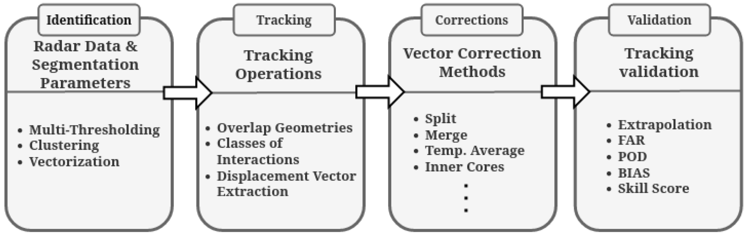
Flowchart of the method applied for tracking and validation of the precipitating systems (Font: Leal HB Et al. 2022).